What makes Utah the idyllic location for an Inland Port?
Expanding and supporting statewide and regional growth is no small feat for any state. But today, Utah’s location at the crossroads of America’s West, combined with its open spaces and booming economy, make the Beehive State the ideal location for logistics-based development.

Want to learn more about the logistics history and geography of Utah, and use the interactive map?
Mapping Out the Path Ahead
UIPA is not only working to move Utah forward, but we are also ensuring that our established groundwork has longevity, staying power, and can support sustainable growth for generations to come.
Use The Interactive Maps to Learn More
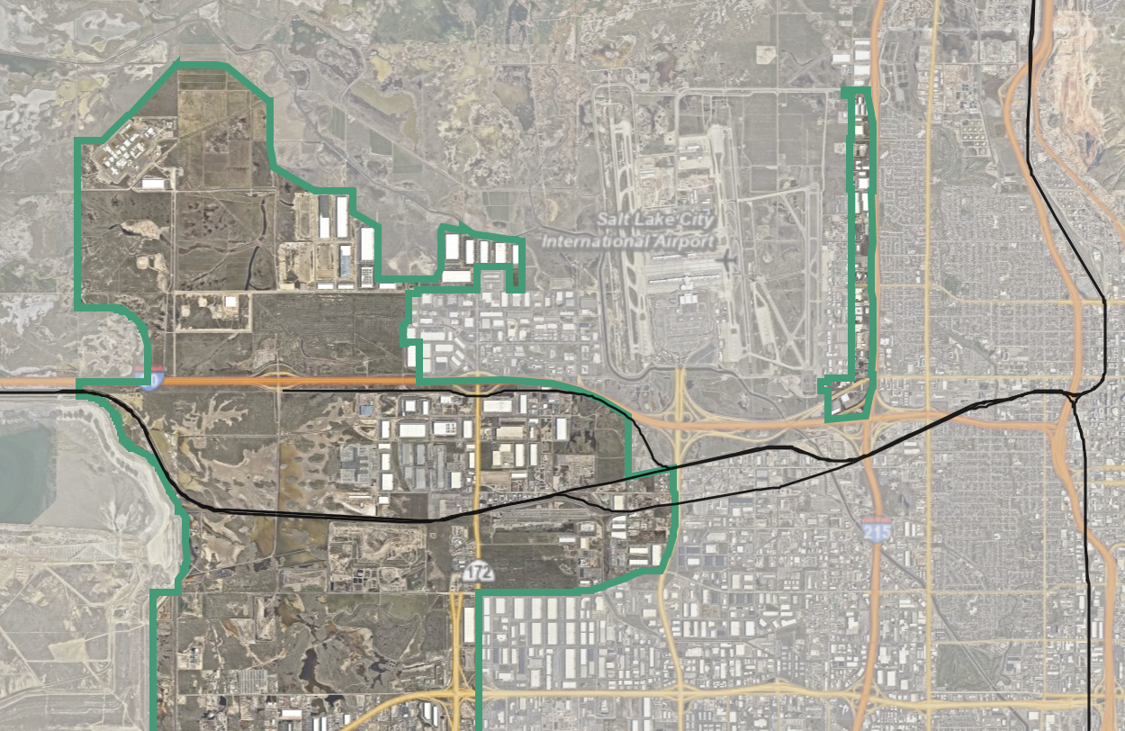
UIPA Zoning Map
This map identifies property zoning ordinances within the UIPA jurisdiction and defines land use within a community for: commercial, residential, industrial and parks. It’s important to remember that the UIPA has no zoning authority and ordinances are drafted, passed, and implemented, by the municipalities in which the UIPA jurisdiction overlaps. The municipalities include: Salt Lake City, West Valley City and Magna Metro Township.
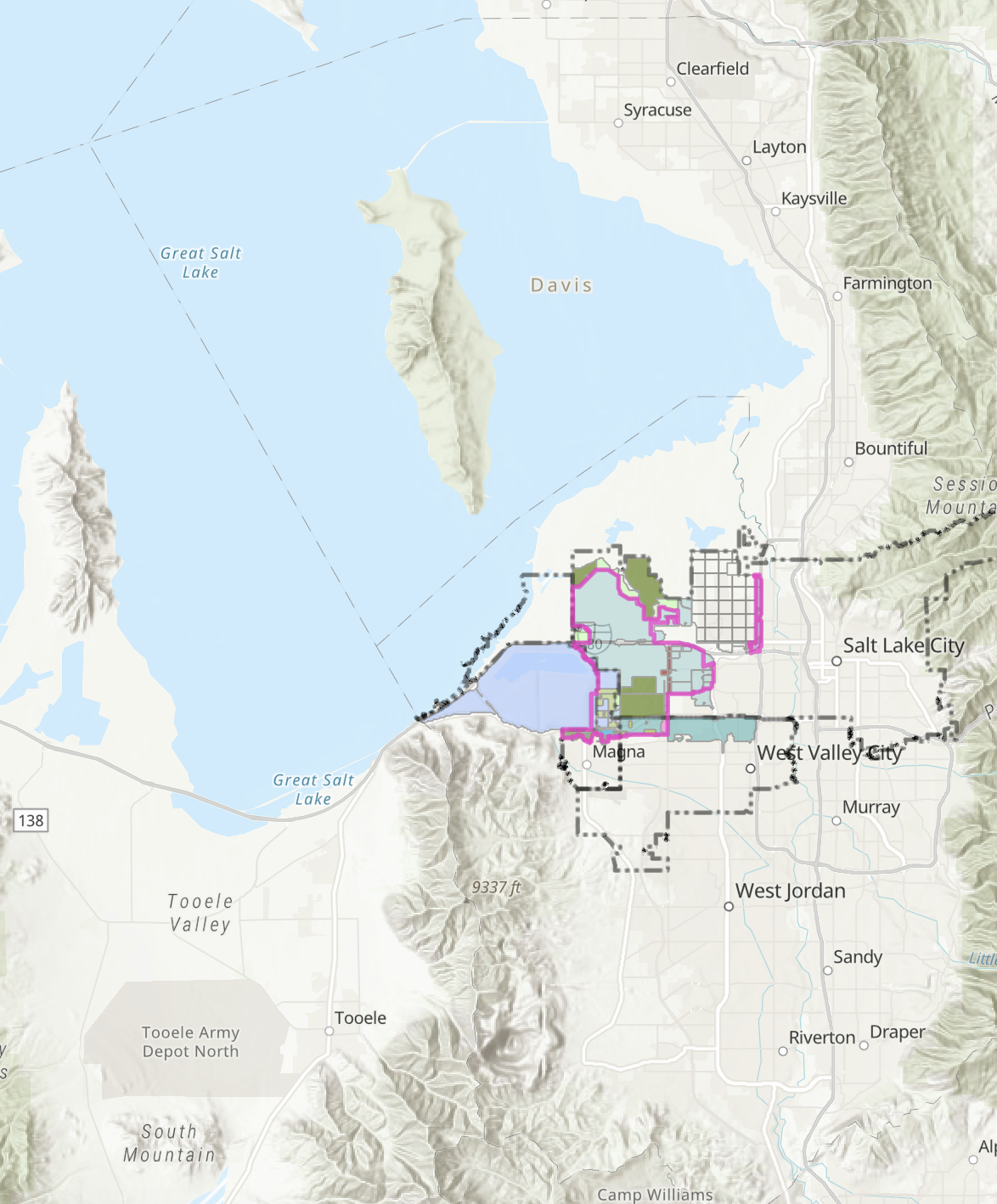
UIPA Jurisdictional Area Map
The current Utah Inland Port jurisdictional area is made up of approximately 16,000 acres in one of the few remaining undeveloped areas of Salt Lake County. Most of the area is privately-owned and approximately 7,000 acres are vacant and suitable for development. It sits at the intersection of two interstate freeways, major national railways and an international airport, which puts the area in high demand for expanding warehouse, distribution and manufacturing.
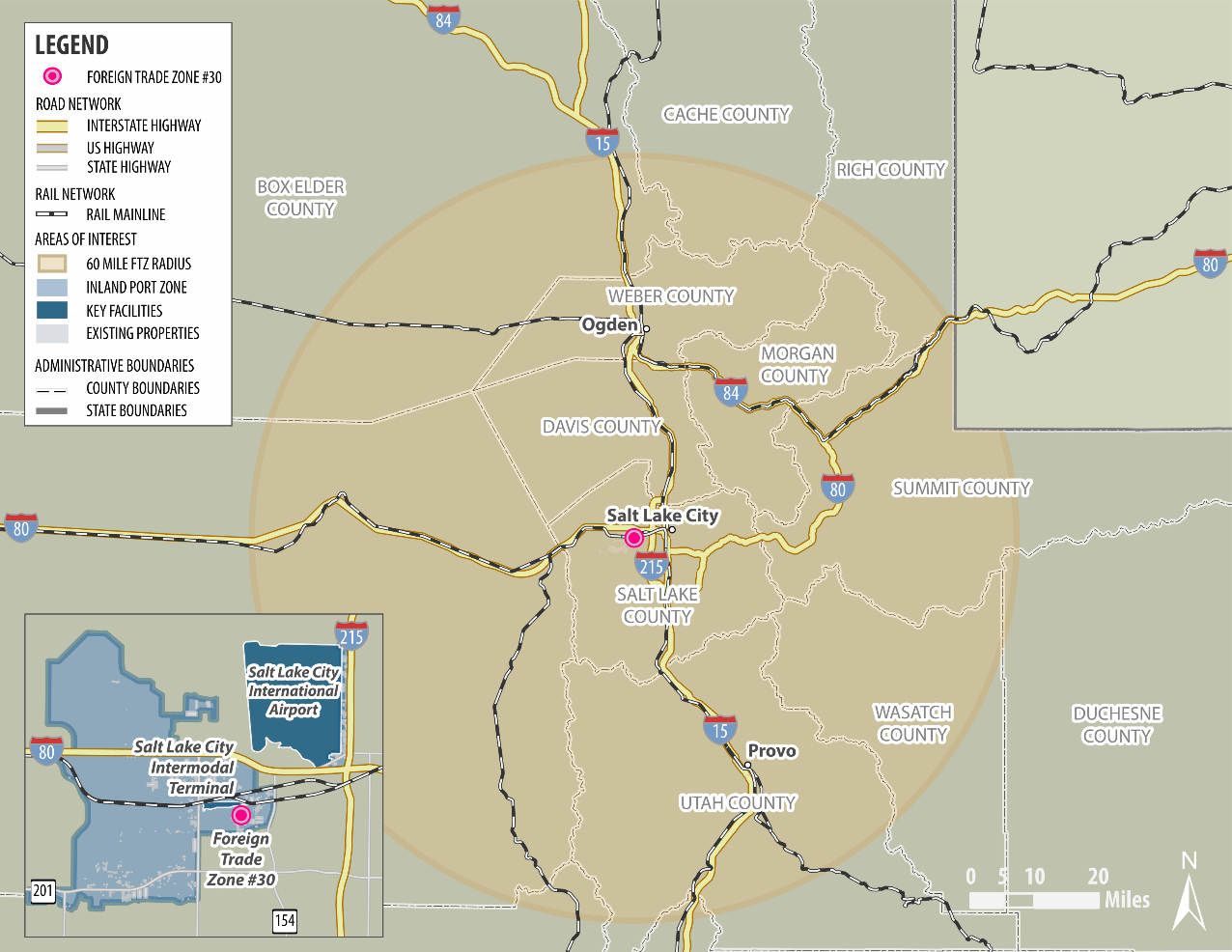
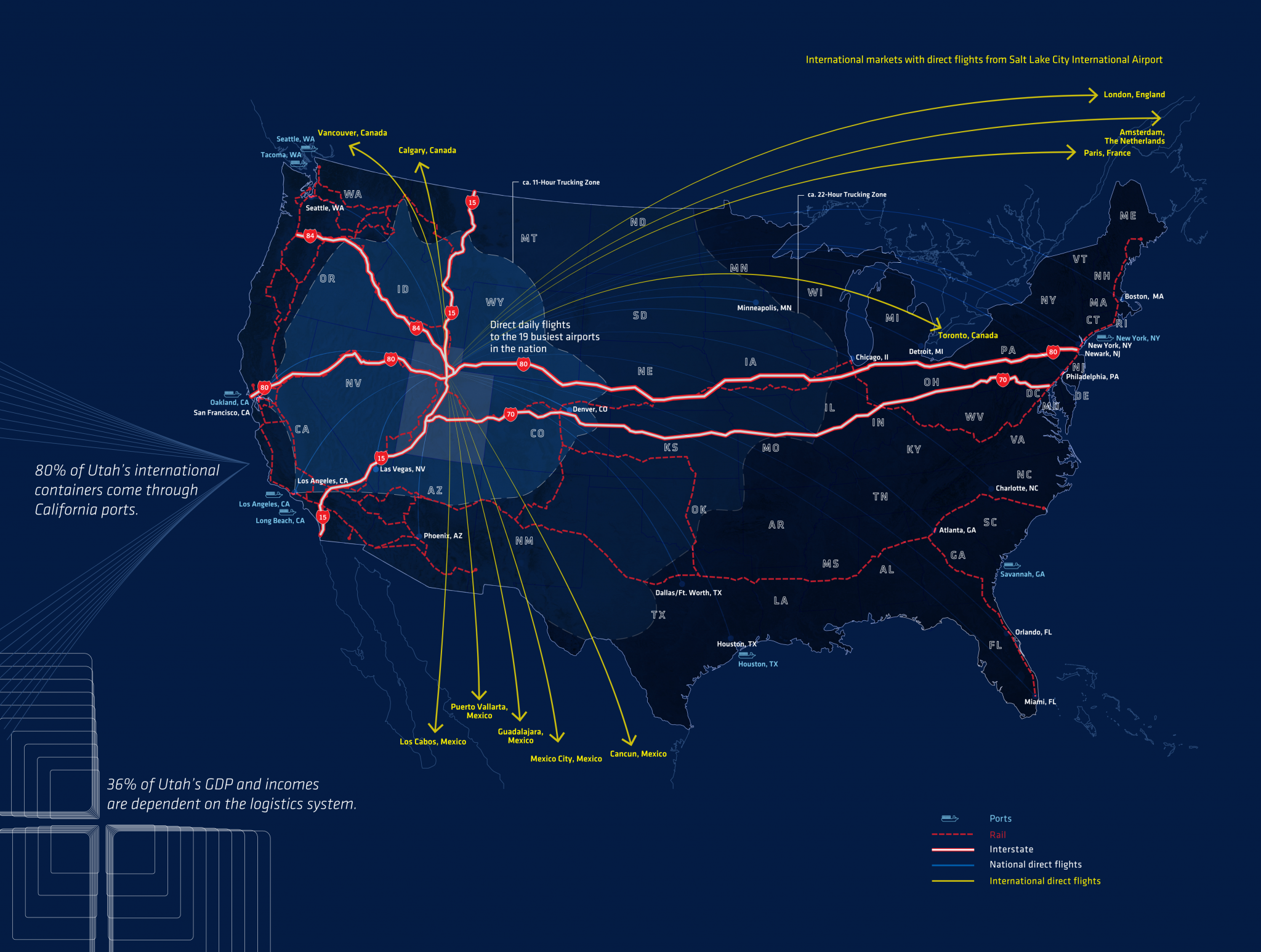
Utah Global Connections Map
Utah’s Foreign Trade Zone:
Areas Eligible for Business FTZ Certification